


Tech

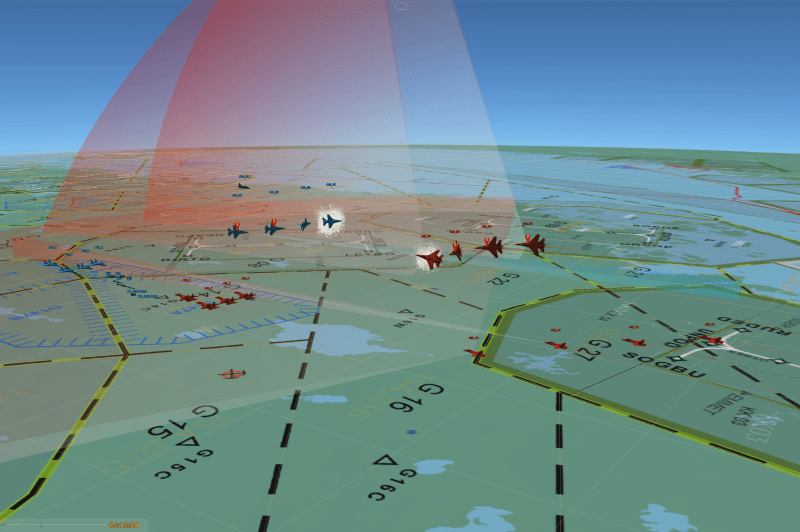
Patria DOME provides real-time situational awareness by receiving data from other systems through standardized APIs. Patria DOME has been built to handle even the most unconventional location data formats and bring everything together for easier interpretation.The information is presented in map layers, so your command can see the situation developing on several different levels and make the right decisions for the mission. In addition, Patria DOME provides data access for AI data analytics tools to enrich reported information. The system is designed to be flexible. Patria DOME is based on Docker container microservice architecture. Thanks to its structure, Patria DOME can run a stripped version for a single portable device, or for hundreds of people in a dedicated data center.
Data Collector & Distributor (DCD) collects the data from external sources and saves it to CORE database. This data is again automatically processed into reports, that have both static and dynamic map layers. It also supports time series map layers, so that the user can run through both past events and future forecasts. Efficient user management ensures the right people get the right intel. You can interact with the objects on the map by commenting on them and assigning them to other users. Data visibility to different user groups can be restricted diversely, including geographic restrictions. Patria DOME also includes automated publishing service, which allows the user to upload a file (e.g. NATO Vector Graphics image) to the servers, which becomes available as a map layer to other users.